Disasters rarely wait for good data. A hurricane forecast has to be issued before the storm turns. Flood maps need to be updated before the water rises. Responders must decide where to send crews while calls, photos, and satellite images pour in at once. Artificial intelligence is now helping with each of these problems. It’s also creating new risks that teams often underestimate. This guide explains where AI adds real value, where it doesn’t, and what technology leaders should check before adopting it.
What Is AI in Disaster Management?
Artificial intelligence in disaster management is the use of machine learning and related techniques to predict, detect, and respond to natural and human-caused disasters. It turns large volumes of sensor, satellite, weather, and social media data into forecasts, risk maps, and prioritized actions that emergency teams can use.
Core techniques behind the tools
Most systems rely on a few common approaches:
- Machine learning models that find patterns in historical events and predict where floods, fires, or landslides are likely to occur
- Computer vision that analyzes satellite and drone imagery to spot damaged buildings, flooded roads, or active fire perimeters
- Natural language processing that sorts emergency calls and social media posts by urgency and location
- Optimization algorithms that help plan evacuation routes, supply deliveries, and crew assignments
The key point is that AI rarely works alone. It supplements sensors, weather models, and trained staff.
The Four Phases Where AI Makes a Difference
Emergency managers often describe disaster work in four phases. AI is useful in each, but the data and risks differ.
| Phase | Main goal | Typical AI use | Main risk |
|---|---|---|---|
| Mitigation | Reduce future risk | Hazard mapping, risk scoring | Outdated training data |
| Preparedness | Get ready before an event | Early warning, forecast modeling | False alarms |
| Response | Act during the event | Situational awareness, triage | Errors under pressure |
| Recovery | Rebuild and assess losses | Damage detection from imagery | Overreliance on automated scores |
Mitigation and risk mapping
Machine learning can combine elevation data, land use, rainfall history, and past damage records to rank areas by risk. This helps planners decide where to fund levees, firebreaks, or building codes. The output is only as good as its inputs. A model trained on a decade of data that predates a major development project may miss new flood paths entirely.
Preparedness and early warning
Forecasting is one of the most mature applications. AI models can run faster than traditional physics-based simulations in some cases, which allows more frequent updates. Google’s Flood Hub, launched in 2018, is one example of a public-facing flood forecasting tool that uses machine learning. Weather-focused AI models are also being tested alongside traditional forecasts to improve speed and coverage.
Speed matters, but so does trust. A warning that arrives early and turns out to be wrong can make residents ignore the next one.
Response and situational awareness
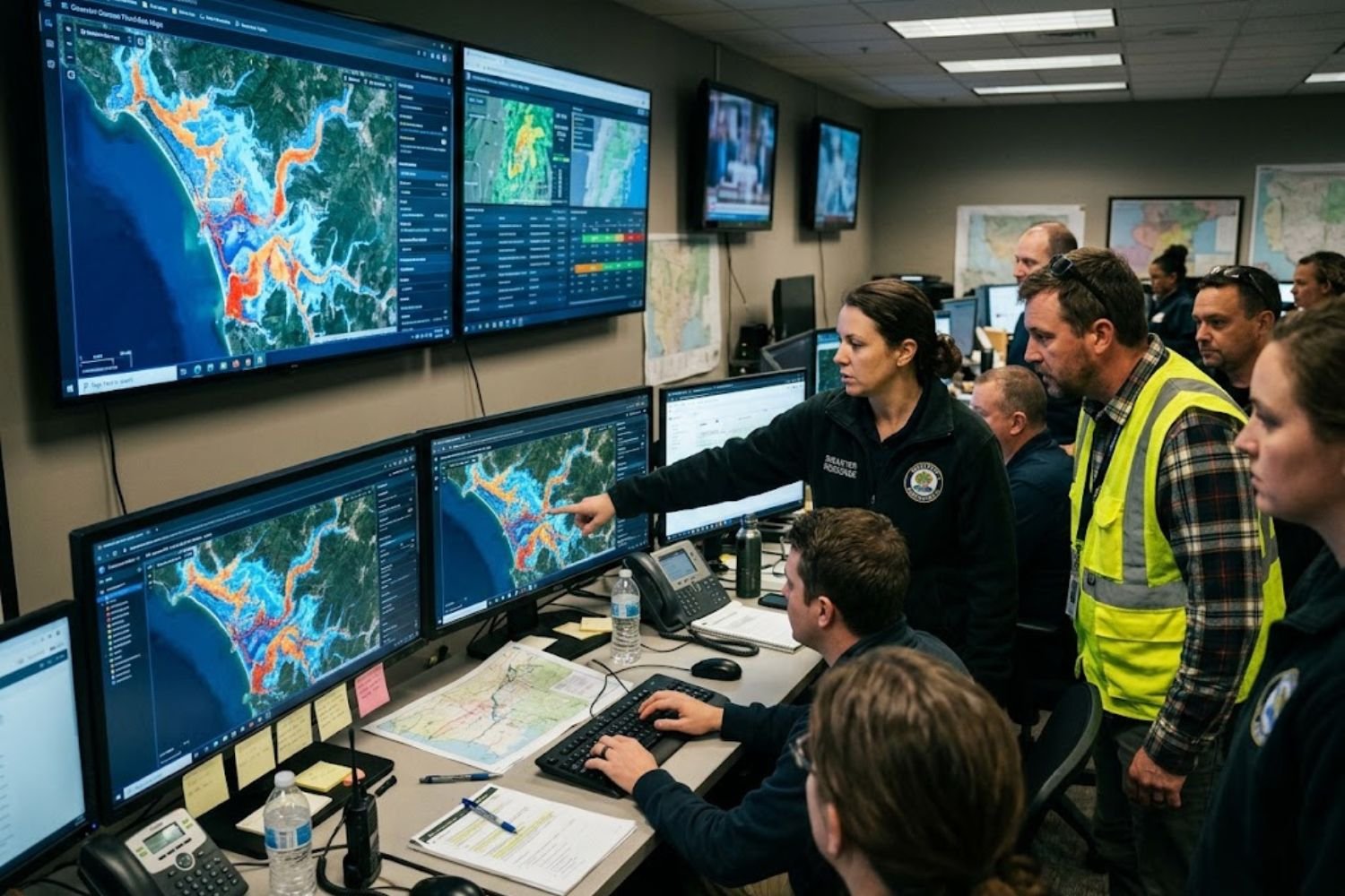
During an active event, the bottleneck is usually information, not a lack of it. Teams may receive thousands of reports and images within hours. Natural language processing can group reports by location and severity, and computer vision can flag photos that show trapped people or blocked roads. This lets human dispatchers focus on the most urgent calls first.
Wildfire detection offers a clear example. Some state programs, including ALERTCalifornia, combine camera networks with automated image analysis to flag smoke early. Human reviewers confirm alerts before crews are dispatched.
Recovery and damage assessment
After a disaster, agencies need to know which buildings are damaged and how badly. Sending inspectors to every structure can take weeks. Computer vision applied to pre- and post-event satellite or aerial imagery can estimate damage across large areas quickly. Those estimates then guide inspection priorities and aid distribution.
Automated scores should guide inspections, not replace them. Imagery can’t always see structural damage under a roof or distinguish between flood damage and older wear.
A Practical Example: AI During a Flood Response
The following scenario is illustrative, not a specific case study.
Imagine a county emergency operations center during a fast-moving river flood. The team has three inputs:
- A river gauge forecast updated every hour
- A stream of 911 calls and public reports
- Drone and satellite images of flooded areas
A well-designed system would do the following:
- Use forecast models to estimate which neighborhoods could flood in the next six hours
- Cluster incoming reports by location so dispatchers can see hotspots
- Flag images showing blocked roads or submerged vehicles for human review
- Suggest crew routes that avoid newly flooded streets
What the system should not do is decide evacuation orders on its own. The final call belongs to a person who can weigh factors the model can’t see, such as a hospital’s generator capacity or a nursing home’s staffing levels.
Where AI Works Best Today
Strong use cases share a few traits. They involve large volumes of structured or semi-structured data, a clear and measurable output, and a human who can verify the result.
Pros and cons
Pros
- Processes large data volumes faster than manual review
- Provides consistent risk scoring across regions
- Can extend coverage where staff are limited
- Improves prioritization when resources are scarce
Cons
- Quality depends heavily on training data
- Can produce confident-looking errors
- Requires reliable power, connectivity, and maintenance
- Raises questions about privacy, especially with social media and location data
Common Mistakes Teams Make
Based on widely discussed lessons from emergency technology projects, these are the errors that cause the most trouble:
- Building before defining the decision. Start with the question a responder needs answered, such as “Which roads will flood in the next three hours?” Then find data for that question.
- Ignoring the offline scenario. Many disasters knock out power and networks. A tool that requires cloud access may be useless when it’s needed most.
- Treating accuracy as a single number. A model with high overall accuracy can still miss rare, severe events. Check performance on the events that matter most.
- Skipping the user test. Dispatchers, field crews, and incident commanders should try the interface under time pressure before deployment.
- Forgetting maintenance. Models drift as land use and climate patterns change. Plan for retraining and monitoring.
Limitations You Can’t Ignore
Data gaps and bias
Disaster data is often uneven. Wealthier areas usually have better sensors, more reports, and more detailed maps. A model trained on that data may underestimate risk in under-monitored communities. Teams should audit where their data comes from and which areas are underrepresented.
False alarms and alert fatigue
Every false alarm makes the next warning less likely to be taken seriously. Setting thresholds involves a tradeoff: fewer false alarms may mean missed events. Agencies should decide that balance deliberately, with input from the communities affected.
Connectivity and power loss
Edge computing, where analysis runs on local devices, is one way to keep tools working when networks fail. Teams should test what happens when the connection drops mid-operation.
Explainability and accountability
When a model flags a bridge as unsafe, responders need to know why. Simple explanations, such as showing which inputs drove a prediction, help people decide whether to trust the output. Clear ownership matters too. Someone must be accountable when an automated recommendation goes wrong.
How to Evaluate an AI Disaster Tool: A Decision Framework
Use these questions before adopting any system:
- What decision does this support? If you can’t name it, pause.
- What data does it need, and do we have it for every area we serve?
- What happens when it’s wrong? Estimate the cost of false positives and false negatives.
- Can it work offline or with degraded connectivity?
- Who reviews its outputs, and how quickly?
- How will we monitor performance and retrain the model over time?
- Can responders understand the output well enough to challenge it?
If the answer to question 1 or 5 is unclear, the tool is not ready for live use.
Beginner, Intermediate, and Advanced Questions Answered
Beginner: Can AI predict disasters? It can estimate the likelihood of some hazards, such as floods or wildfire spread, but it can’t predict exact timing or location with certainty. Its strength is improving warning lead time and prioritizing attention.
Intermediate: How is AI different from traditional forecasting? Traditional models rely on physics equations. AI models learn patterns from historical data. Many modern systems combine both approaches.
Advanced: What should engineers focus on? Prioritize calibration (whether predicted probabilities match real outcomes), out-of-distribution testing (how models handle events unlike their training data), and integration with existing incident command systems.
Key Takeaways
- AI supports every phase of disaster management, but it works best as a decision aid, not a decision maker.
- Early warning, situational awareness, and damage assessment are the most practical current uses.
- Data gaps, bias, and false alarms are the biggest technical risks.
- Offline operation, user testing, and ongoing maintenance are often overlooked.
- Define the decision first, then choose the technology.
Frequently Asked Questions
Is AI used in disaster management today?
Yes. It’s used in forecasting, wildfire detection, satellite-based damage assessment, and processing emergency reports. Adoption varies widely across agencies.
Can AI replace emergency managers?
No. AI can support analysis and prioritization, but people make decisions about evacuations, resource allocation, and public communication.
What is the biggest risk of AI in disaster response?
Overreliance on outputs that look precise but are based on incomplete or biased data.
Does AI improve early warning systems?
It can extend lead time and coverage, especially for flash floods and wildfires, but warnings still depend on sensors, forecasts, and communication systems.
How does AI analyze satellite images after a disaster?
Computer vision models compare before and after images to flag likely damage. Human inspectors then verify the results.
What data is needed for AI flood prediction?
Typically rainfall, river levels, elevation, soil conditions, land cover, and historical flood records.
Is AI in disaster management reliable?
Reliability depends on the specific tool, its training data, and how it’s used. Independent validation is essential.
What skills do teams need to build these systems?
Data engineering, machine learning, GIS, domain expertise in emergency management, and user experience design for high-stress environments.
Can small agencies use AI tools?
Yes, often through shared regional platforms or open-source tools. Small teams should prioritize simple, well-tested use cases.
How do privacy concerns apply?
Location data and social media posts can expose individuals. Teams should minimize data collection, anonymize where possible, and set retention limits.
What is human-in-the-loop?
A design approach where people review and approve automated outputs before action is taken.
Are there government guidelines for AI in emergency management?
Agencies such as FEMA and NOAA publish information on emergency management and weather data. Check current guidance from relevant agencies before deploying systems.
What should I read next?
Start with official emergency management resources and peer-reviewed research on disaster informatics.
Conclusion
AI is becoming a practical part of disaster management, from forecasting floods to finding damaged buildings after the water recedes. Its value comes from speed and scale, but its risks come from the same sources: data quality, overconfidence, and gaps in real-world conditions. The teams that succeed are the ones that define the decision first, test tools under pressure, and keep people accountable for the final call.
If your organization is evaluating AI for emergency operations, climate resilience, or public safety software, start with a clear decision map and a data audit. Talk with the TechWoid team to plan a practical, responsible path forward.